

sometimes... disasters hit us too.
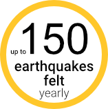
According to World Risk Index 20231, Philippines ranks 1st as the most disaster prone country among 193 countries in the United Nations; for 13 years in a row.2


*Check sources below3
Be disaster ready. Let us guide you step by step.


Typhoon or tropical cyclone (bagyo) is an intense low-pressure system with minimum sustained winds of 35kph (kilometers per hour).
These typhoons can have strong winds and heavy rainfall that causes widespread flooding, storm surges, landslides and mudflows.


MONITOR THE NEWS FOR WEATHER UPDATES
Monitor the news for weather updates, warnings and advisories.
Know the early warning and evacuation plan of the community.
Check the integrity of your house and repair weak parts.
Prepare your family’s Emergency GO BAG containing items needed for survival.
Put livestock and pets in a safe area or designated evacuation site for animals.
When notified, immediately go to the designated evacuation center.
STAY ALERT AND STAY TUNED.
Stay calm. Stay indoors and tune in for latest news and weather updates.
In case of flooding, turn off main electrical switch and water valve.
Use flashlight or emergency lamp. Be cautious in using candles and gas lamps.
Stay away from glass windows.
REMAIN ALERT AND BE CAUTIOUS.
Wait for authorities to declare that it is safe to return home.
Stay away from fallen trees, damaged structures and power lines.
Do not go sightseeing as you may hinder the work of the emergency services.
Be cautious in checking and repairing the damaged parts of your house.
Check for wet or submerged electrical outlets and appliances before turning on electricity.
Throw away rainwater in cans, pots and tires to prevent breeding of mosquitoes.

FLOOD is a great flow of water overflowing from streams and other bodies of water, as well as by the accumulation of rainwater by drainage. Floods can cause severe damages to lives and properties.


KNOW THE HAZARDS IN YOUR AREA
Monitor the news for weather updates, warnings and advisories.
Know the flood early warning and evacuation plan of the community.
Participate in community flood preparedness actions and drills.
Secure your home. Move essential furniture and items to the upper floor.
Before evacuating, turn off main switches of electricity, water and LPG tanks.
Put livestock and pets in a safe area or designated evacuation sites for animals.
When order is received, immediately evacuate to higher and safer grounds.
STAY ON HIGHER GROUNDS
Stay indoors and stay tuned for latest news and weather updates.
Do not touch electrical equipment if you are wet or standing on floodwater.
DO NOT go swimming or boating on swollen rivers.
DO NOT cross streams when water level is already above the knee.
DO NOT walk or drive through flooded areas.
STAY ALERT AND KEEP SAFE
Leave the evacuation area only when authorities say it is safe to return home.
Report fallen trees and electric posts to proper authorities.
Check for wet or submerged electrical outlets and appliances before turning on electricity.
Check your house for possible damages and repair as necessary.
Make sure that the food and water for drinking are not contaminated by flood water.
Throw away rainwater in cans, pots and tires to prevent breeding of mosquitoes.

An earthquake is a feeble shaking to violent trembling of the ground produced by the sudden displacement of rocks or rock materials below the earth ‘s surface.
TECTONIC EARTHQUAKES are generated by the sudden displacement along faults in the solid and rigid layer of the earth.
VOLCANIC EARTHQUAKES are induced by rising magma beneath active volcanoes.


For more information on active faults, visit PHIVOLCS Fault Finder


INTENSITY I: Scarcely Perceptible –
Perceptible to people under favorable circumstances.
Delicately balanced objects are disturbed slightly.
Still water in containers oscillates slowly.
INTENSITY II : Slightly Felt -
Felt by few individuals at rest indoors.
Hanging objects swing slightly.
Still water in containers oscillates noticeably
Intensity III : Weak -
Felt by many people indoors especially in upper floors of buildings. Vibration is felt like one passing of a light truck.
Dizziness and nausea are experienced by some people.
Hanging objects swing moderately.
Still water in containers oscillates moderately.
INTENSITY IV : Moderately Strong –
Felt generally by people indoors and by some people outdoors. Light sleepers are awakened. Vibration is felt like the passing of a heavy truck.
Hanging objects swing considerably. Dinner plates, glasses, windows, and doors rattle. Floors and walls of wood-framed buildings creak. Standing motor cars may rock slightly.
Liquids in containers are slightly disturbed. Water in containers oscillates strongly.
Rumbling sound may sometimes be heard.
INTENSITY V : Strong -
Generally felt by most people indoors and outdoors. Many sleeping people are awakened. Some are frightened, some run outdoors. Strong shaking and rocking felt throughout building.
Hanging objects swing violently. Dining utensils clatter and clink; some are broken. Small, light, and unstable objects may fall or overturn.
Liquids spill from filled open containers. Standing vehicles rock noticeably. Shaking of leaves and twigs of trees are noticeable.
INTENSITY VI - Very Strong
Many people are frightened; many run outdoors. Some people lose their balance. Motorists experience a sensation of driving on flat tires.
Heavy objects or furniture move or may be shifted. Small church bells may ring. Wall plaster may crack. Very old or poorly built houses and man-made structures are slightly damaged, though wellbuilt structures are not affected.
Limited rockfalls and rolling boulders occur in hilly to mountainous areas and escarpments. Trees are noticeably shaken.
INTENSITY VII : Destructive
Most people are frightened and run outdoors. People find it difficult to stand in upper floors.
Heavy objects and furniture overturn or topple. Big church bells may ring. Old or poorly- built structures suffer considerable damage. Some well-built structures are slightly damaged. Some cracks may appear on dikes, fish ponds, road surface, or concrete hollow block walls.
Limited liquefaction, lateral spreading and landslides are observed. Trees are shaken strongly.
INTENSITY VIII : Very Destructive
People are panicky. People find it difficult to stand, even outdoors.
Many well-built buildings are considerably damaged. Concrete dikes and foundation of bridges are destroyed by ground settling or toppling. Railway tracks are bent or broken. Tombstones may be displaced, twisted or overturned. Utility posts, towers and monuments may tilt or topple. Water and sewer pipes may be bent, twisted or broken.
Liquefaction and lateral spreading cause man-made structures to sink, tilt, or topple. Numerous landslides and rockfalls occur in mountainous and hilly areas. Boulders are thrown out from their positions, particularly near the epicenter. Fissure- and fault-rupture may be observed. Trees are violently shaken. Water splashes or slops over dikes or banks of rivers.
INTENSITY IX : Devastating
People are forcibly thrown to the ground. Many cry and shake with fear.Most buildings are 15 totally damaged. Bridges and elevated concrete structures are toppled or destroyed. Numerous utility posts, towers, and monuments are tilted, toppled, or broken. Water sewer pipes are bent, twisted, or broken.Landslides and liquefaction with lateral spreadings and sandboils are widespread. The ground is distorted and undulates. Trees are shaken very violently, with some toppled or broken. Boulders are commonly thrown out. River water splashes violently or slops over dikes and banks.
INTENSITY X : Completely Devastating
Practically all man-made structures are destroyed.
Massive landslides and liquefaction, large scale subsidence and uplifting of land forms, and many ground fissures are observed. Changes in river courses and destructive seiches in large lakes occur. Many trees are toppled, broken and uprooted.

KNOW THE HAZARDS IN YOUR AREA.
Familiarize yourself with the following:
•Fire extinguishers (Mga pang-apula ng apoy).
•Medical kit (Mga gamit pang-medikal).
•Exit routes (Ligtas na daanan palabas ng gusali).
•Evacuation plan
Check your house and have it repaired if necessary.
Store harmful chemicals and flammable materials properly.
Secure heavy furniture and hanging objects.
Prepare your family’s GO BAG containing items needed for survival.
Participate in office and community earthquake drills.
WHEN INSIDE A BUILDING, STAY CALM DO THE:
DUCK - COVER- HOLD
Duck under a strong table and hold on to it. Stay alert for potential threats.
Stay away from glass windows, shelves and heavy objects.
After the shaking stops, exit the building and go to the designated evacuation area.
WHEN YOU ARE OUTSIDE, MOVE TO AN OPEN AREA!
Stay away from buildings, trees, electric posts and landslide prone areas.
If you’re in a moving vehicle, stop and exit the vehicle.
STAY ALERT FOR AFTERSHOCKS!
Assess yourself and others for injuries. Provide first aid if necessary.
Prioritize the needs of older persons, pregnant women, PWDs and children.
If in a coastal area and there is a threat of a tsunami, evacuate to higher ground immediately.
Check for spills of toxic and flammable chemicals.
Stay out of the building until advised that it is safe to return.
Check for damages in water and electrical lines, and gas or LPG leaks.


Volcano is a mountain or a hill that has a crater or vent where lava, rocks, hot vapors or gas are ejected from the deep layers of the Earth.
Active Volcanoes - are volcanoes that erupted within historical times (within the last 600 years)
Potentially Active Volcanoes - are volcanoes that have not erupted in the last 600 years but still exhibit signs of geological activity. So, it might seem calm now, but there's a possibility of an eruption in the future. It usually appears young in form and structure like newly formed volcanoes that hasn't erupted yet.
Inactive Volcanoes (Extinct volcanoes) are volcanoes that haven't erupted for more than 10,000 years and are unlikely to erupt again. These volcanoes often show signs of significant erosion, which can create deep gullies on their surfaces.


LAVA FLOW
Lava flows are rivers of incandescent of molten rock or lava moving downslope or away from an eruption vent. Lava flows composed of low silica magma have low viscosities and tend to flow at high speeds (kilometers per hour), while those composed of high silica magma have high viscosities and tend to move slowly (kilometers per day). Steep slopes encourage faster and longer flows than gentle slopes or terrain.
ASH FALL
Ash Fall are volcanic particles propelled through the atmosphere in an eruption cloud that eventually fall over areas of an erupting volcano.
LAHAR (VOLCANIC MUDFLOWS)
Lahar or volcanic mudflows are a mixture of water, pyroclastic material like volcanic rock, and ash from the eruption and rocky debris that rapidly flows down the slopes, through rivers and channels..
This is just a general criteria per volcano alert level, PHIVOLCS have different alert level criteria for volcanoes as each volcano has its own characteristics and behavior.

KNOW THE SIGNS OF AN IMPENDING ERUPTION
Increase in the frequency of volcanic quakes accompanied by rumbling sounds.
Change in the color of steam emission from white to gray.
Drying up of vegetation, springs and wells around the volcano.
Development of new thermal areas or reactivation of old ones.
KNOW THE COMMUNITY'S SAFETY PLANS
Always monitor the volcano updates and watch out for advisories and warnings.
Know the location of the evacuation site and the fastest and safest way to go up there.
Preparing your family's Emergency GO BAG containing items needed for survival.
STAY AWAY FROM DANGER ZONES
When notified, immediately evacuate to safe grounds.
Assist in evacuating children, pregnant women, PWD and older people.
Cover your mouth with wet cloth and protective goggles.
Keep your pets in their shelter or inside to avoid them from inhaling ash.
Stay away from rivers and streams for possible lahar flow.
REMAIN ALERT AND BE CAUTIOUS
Leave the evacuation area only when the authorities say itis safe.
Wear masks when cleaning.
Scrape the accumulated ash in roofs to prevent collapse.
Shake all loose ash on plants before watering.

Test your knowledge about the powerful forces that shape the Philippines. From earthquakes to volcanic eruptions, dive into the heart of disaster resilience!
Start Quiz
The first step of every disaster preparedness is hazard assessment.
Hazard assessment is a thorough check of the environment to identify potential risks and hazards. The purpose of a hazard assessment is to identify safety measures to mitigate the identified hazards.
Get a map. You can use hazard maps that includes location of hazards like fault lines and flood prone areas.
We recommend the Hazard Hunter PH as a map in your hazard assessment.
These are guide questions that you can use to analyze the dangers in your location:
1. Is it a flood prone area?
2. Are you near flood ways and other big bodies of water? Rivers and creeks can overflow. Floodways, valleys and catch basins collect water from other places and prone to flash-floods.
3. Is it located near the coastline? Coastlines are prone to storm surges during typhoons, and tsunami during earthquakes.
4. Is it located near a trench or a fault line? These areas are more susceptible to earthquakes.
5. Is it within or near a volcanic danger zone? These areas are dangerous during volcanic activities.
After identifying the dangers in your terrain, identify the safe spaces. This is where you can stay or be your rendezvous point in case your family get separated.
Safe areas differ depending on the scenario.
High ground is safer in case of flooding, storm surges and tsunami.
Open spaces are better in case of earthquakes, because you are safe from falling debris. Join earthquake drills so you'd know where the designated place is.
Once you've identified the safe areas, find out what the best routes are to get there. Avoid flood-prone areas.
In case of emergency you might need to get services from key facilities like evacuation centers, health clinics, nearest schools, hospitals and local government offices like the Baranggay Hall.
Check your home for potential hazards.
Typhoons are often accompanied by strong winds and flooding, keep that in mind when checking.
Check for holes on the roof and repair to prevent leaks and water damage.Check if the roof and windows are secured from strong winds.Check your outdoor ornaments and furnitures, it is dangerous to leave them outside when the wind is strong. It could be blown away and cause damage to your home. Secure it or put it inside the house before the storm.If you are in a flood prone area, know how high it gets. Elevate your things to keep it safe from flood water.
Earthquakes involves intense ground shaking.
Secure items on shelves to prevent them from toppling.
Check if your house is up to code for earthquakes.
Take the quiz on house safety

Use Hazard Hunter PH in your hazard assessment.
HazardHunterPH is the country's one-stop shop for hazard assessment.
Find out if a location is prone to earthquake, volcanic, or storm hazards.Generate hazard assessment reports.See which critical facilities and areas in the Philippines are prone to different hazards.All hazard information used for assessment has been generated by government agencies.
Now that you've identified the dangers in your area and your home, as well as the safe places and routes, we need to create an emergency plan.


Planning for emergencies not only includes what you will do during emergencies but should also include proactive measures in preventing the occurrence of these emergencies on a personal and community level.
Now that you are familiar with disasters and already did a hazard assessment:
During disasters, you might have to rely on yourselves and survive on your own for several days. You may not have access to medical facilities, supplies for your daily needs could be limited. Knowing these things will help you plan and prepare for disasters.
To start your emergency plan, discuss and think about the questions below with your household or your team.
1. How will you receive information, alerts and warnings?
2. What is your plan for staying at home/work/school to take shelter?
3. What is your evacuation route?
4. What is your communication plan?
5. Is your emergency bag and first aid kit up to date?
6. How do you address each other's special needs?

The family should prepare for the hazards that they might face. Follow the following guide in preparing the family.
.webp)
Local officials including school and workplace administrators can lead by well-planned activities aimed at building a ready community. The following guidelines can assist leaders in keeping communities safe and prepared:
When making plans for the community, consider the additional needs of PWDs.
When the family evacuates, it is necessary to prepare it to ensure the safety of the whole family. The following are tips for safe evacuation:
In the Philippines we don't have a lot of dedicated evacuation centers yet. Often schools, barangay hall, covered courts, churches, and multi-purpose halls serve as evacuation centers. If you can't find a dedicated one near you, try to look for these instead. Coordinate with your local authority.
"Once the disaster strikes, it will not discriminate against anyone."
"Hindi porket PWD ka, hindi ka na pwedeng maghanda. Hindi pwedeng aasa na lang tayo (PWDs) sa mga kapwa natin when it comes to disaster preparedness. We should get involved and know the hazards to prepare for it."
"Because we never know when a disaster or an emergency will happen, PWDs should always be on guard, take necessary safety and prevention measures and communicate with their network."
- Joel Tangunan
Vice President of the Pangasinan Persons with Disability (PWD) Federation
Disaster affects everyone. But persons with disabilities are twice more likely to lose their lives or be injured than the general population during disasters. Making disaster preparedness much more critical. Here's a guide shared by Joel Tangunan to his fellow PWDs:
Pets and animals are part of the family or livelihood. Consider them during disasters. If local authorities advise you to evacuate, that means your pets will evacuate too. If they are left behind, they could be lost, injured or die.

Building your emergency bag (go bag) doesn't need to be costly. Follow these tipid tips:


Creating an Emergency Communication Plan is essential to ensure that everyone in your household can stay connected and informed during emergencies; especially if you get separated. Here are the steps to create an effective plan:
1. Collect Contact Information:
Write down phone numbers and email addresses for all household members, extended family, close friends and important offices (like hospitals, clinics, doctors, schools, service providers, workplace)
Include information for special needs, like for children, for elderly members, for PWD, pets and care givers.
2. Share the Plan
Create a physical copy of the contact information (print or handwritten) and distribute it to each household member. Make sure they have it with them all the time.
Have a copy at home and save it on your phones for easy access.
3. Update the information every now and then.
Purpose: To be able to contact family members in case of emergencies. In case you are separated, you have no signal or your phone broke, you can use another phone and still call them or the places they frequent to look for them.

Purpose: To be able to contact other people you can ask for help. It could be a relative outside the disaster area or friends who can help you rebuild or call emergency personnel for you. You can also include Care givers, Teachers and Doctors, Church and community leaders.
Purpose: To be able to contact authorities in your area in case you would need to gather information or ask for assisstance.
Science Garden Compound, Senator Miriam P. Defensor-Santiago Avenue, Barangay Central, Quezon City, Metro Manila, Philippines 1100

PHIVOLCS Building, C.P Garcia Ave., U.P. Diliman, Quezon City, Philippines 1101

National Headquarters, Camp BGen Rafael T Crame, Quezon City

Agham Road, Barangay Bagong Pag-Asa, Quezon City
National Headquarters Philippine Coast Guard
139 25th Street, Port Area, Manila 108, Philippines

NDRRMC Building, Camp General Emilio Aguinaldo, Quezon City

Office of Civil Defense, Camp General Emilio Aguinaldo, Quezon City, Philippines
1 World Risk Report 2023. Bündnis Entwicklung Hilft, Ruhr University Bochum – Institute for International Law of Peace and Conflict 2023. https://weltrisikobericht.de/en.
2 World Risk Index 2023: Philippines remains the most at-risk country for 13th straight year - Business World Online www.bworldonline.com
3 Volcanoes of the Philippines - PHIVOLCS Volcanoes of the Philippines (dost.gov.ph)
3 Tropical Cyclone Information - PAGASA PAGASA (dost.gov.ph)
3 DamagesDue to Natural Extreme Events and Disasters Amounted to PhP 463 Billion |Philippine Statistics Authority | Republic of the Philippines (psa.gov.ph)
3 Whydo we need to understand the Big One? Phivolcs explains (mb.com.ph) - Manila Bulletin https://mb.com.ph/2021/11/25/why-do-we-need-to-understand-the-big-one-phivolcs-explains/
3 CPES2012 to 2022 Component 4 Infographics (psa.gov.ph) - PSA psa.gov.ph
4 PIA - Pangasinense shares emergency, disaster preparedness for Filipino PWDs


